Bipartisan Infrastructure Law helps map critical mineral resources in Utah
USGS-funded surveys of mine waste and untapped, critical resources across the U.S. will aid the country in achieving policy goals.

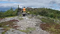
Photo by Taylor Brandon on Unsplash
The grants come from a Bipartisan Infrastructure Law investment in the USGS Mineral Resources Program’s Earth Mapping Resources Initiative (Earth MRI), which supports $74 million in new mapping each year to modernize our understanding of the Nation’s fundamental geologic framework and improve knowledge of domestic critical mineral resources both still in the ground and in mine waste. Overall, the Law invests $510.7 million through the USGS to advance scientific innovation and map critical minerals vital to the nation’s supply chains and economy.
“I’m pleased to announce investments from the Bipartisan Infrastructure Law to improve mapping of Utah’s geology and critical mineral resources,” said Assistant Secretary for Water and Science Tanya Trujillo. “This is a significant investment in the State of Utah’s infrastructure, resilience, and economy and will strengthen key domestic supply chains by helping us secure a reliable and sustainable supply of critical minerals.”
Assistant Secretary Trujillo was in Utah today for the announcement, where she met with USGS scientists and the Utah Geological Survey to learn about the ongoing partnership to track critical minerals, a key step in securing a reliable and sustainable supply of the critical minerals that power everything from household appliances and electronics to clean energy technologies like batteries, wind turbines and solar.
The funding will support the largest airborne geophysical survey ever flown in the region, stretching from the Indian Peak Range in southwestern Utah to Utah Lake in the center of the state. In addition, lidar surveys of region’s topography will be flown, and a grant to the Utah Geological Survey will support geologic mapping and geochemical analyses.
These efforts by the USGS and the Utah Geological Survey will improve the understanding of critical mineral resources within the region, including lithium, beryllium, tungsten and a wealth of other mineral commodities.
“These maps and datasets are essential in many geoscience fields – in addition to mapping critical minerals, the same data will inform infrastructure projects, flood hazards planning and groundwater management and will identify geothermal energy resources and earthquake hazards,” said USGS Director David Applegate. “This work could only come about through close collaboration with our colleagues in the Utah Geological Survey.”
“We are excited for this project and the commitment it represents to furthering Utah's understanding and stewardship of mineral resources, particularly in the new era of critical minerals,” said Stephanie Mills, Senior Geologist with the Utah Geological Survey. “This geophysical survey is the first to create a comprehensive geologic framework over important and unique mineral districts in west central Utah. We are proud to partner with the USGS and be part of a successful state and federal government collaboration that addresses essential research into our nation's mineral resource landscape.”
The Utah Geological Survey will additionally carry out geologic mapping for critical mineral commodities, most notably indium, zinc and manganese, within the surveyed areas. The geologic mapping efforts, which are managed through the USGS National Cooperative Geologic Mapping Program, will refine our understanding of the geology underlying areas of interest. In addition, data preservation efforts managed through the USGS National Geological and Geophysical Data Preservation Program will help make historical critical minerals information electronically available to the public.
The critical mineral commodities to be studied in Utah include:
- Aluminum: used in almost all sectors of the economy
- Arsenic: used in lumber preservatives, pesticides and semi-conductors
- Antimony: used in lead-acid batteries and flame retardants
- Barite: used in hydrocarbon production
- Beryllium: used as an alloying agent in aerospace and defense industries
- Bismuth: used in medical and atomic research
- Cobalt: used in rechargeable batteries and superalloys
- Fluorspar: used in the manufacture of aluminum, cement, steel, gasoline and fluorine chemicals
- Gallium: used for integrated circuits and optical devices like LEDs
- Germanium: used for fiber optics and night vision applications
- Indium: mostly used in LCD screens
- Lithium, used primarily for batteries
- Magnesium, used in furnace linings for manufacturing steel and ceramics
- Manganese: major mineral used in steelmaking
- Platinum group metals: used for catalytic agents
- Rare earth elements: primarily used in magnets and catalysts
- Tantalum: used in electronic components, mostly capacitors
- Tellurium: used in steelmaking and solar cells
- Tin: used as protective coatings and alloys for steel
- Tungsten: primarily used to make wear-resistant metals
- Vanadium: primarily used as alloying agent for iron and steel
- Zinc: uses range from metal products to rubber and medicines
Earth MRI is a partnership between the USGS and state geological surveys across America to modernize our understanding of the Nation’s fundamental geologic framework and knowledge of mineral resources. The Bipartisan Infrastructure Law has accelerated this new mapping in areas with potential for hosting critical mineral resources both still in the ground and in mine wastes.
More information can be found here. To learn more about how the USGS is investing the resources from the Bipartisan Infrastructure Law, visit our website. To learn more about USGS mineral resource and commodity information, please visit our website and follow us on Twitter. To learn more about the Utah Geological Survey, please visit their website and follow them on Twitter.


